Disasters, whether natural or man-made, can cause widespread destruction and loss of life. Effective disaster management is crucial for minimizing the impact of these events. One of the most powerful tools aiding this effort today is geospatial technology. The role of geospatial technology in disaster management has become increasingly vital, providing accurate data, real-time monitoring, and efficient resource allocation.
Understanding Geospatial Technology
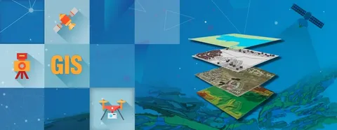
Geospatial technology refers to the tools and techniques used to collect, analyze, and visualize geographic information. This includes Geographic Information Systems (GIS), remote sensing, Global Positioning Systems (GPS), and satellite imagery. These technologies enable disaster management teams to understand spatial patterns and dynamics related to disasters.
Pre-Disaster Preparedness
The role of geospatial technology in disaster management begins long before a disaster strikes. By mapping hazard-prone areas, such as flood zones, earthquake fault lines, or wildfire risks, authorities can identify vulnerable populations and infrastructure. GIS models help in planning evacuation routes and setting up early warning systems, ensuring communities are better prepared.
Real-Time Disaster Monitoring and Response
During a disaster, geospatial technology plays a critical role in providing real-time data. Satellite imagery and GPS tracking allow responders to monitor the progression of events like hurricanes, floods, or wildfires. This information facilitates timely decision-making, helps coordinate rescue operations, and ensures resources are deployed efficiently. The ability to visualize affected areas on maps accelerates response times and improves situational awareness.
Post-Disaster Recovery and Damage Assessment
After a disaster, geospatial technology aids in damage assessment and recovery planning. By comparing pre- and post-event satellite images, authorities can identify the extent of destruction, prioritize areas for relief, and allocate resources effectively. GIS also supports reconstruction efforts by mapping safe zones and planning infrastructure rebuilding.
Enhancing Community Resilience
Beyond immediate disaster response, the role of geospatial technology in disaster management extends to building long-term resilience. Data gathered through geospatial tools helps in formulating policies, improving urban planning, and developing risk reduction strategies. Communities equipped with geospatial insights are better positioned to withstand future disasters.
Conclusion
The role of geospatial technology in disaster management is indispensable. From preparedness and real-time response to recovery and resilience building, geospatial tools empower authorities to make informed decisions, save lives, and reduce economic losses. As technology advances, integrating geospatial solutions into disaster management frameworks will continue to enhance global efforts in mitigating the impacts of disasters.


